
Over 14,000 Urgent Care locations, catalogued.
The National UC Realty Urgent Care database contains over 14,000 Urgent Care locations. Using this powerful database, we can quickly analyze existing Urgent Cares to establish key benchmarks in our site selection process.
Urgent Care Clinic Information
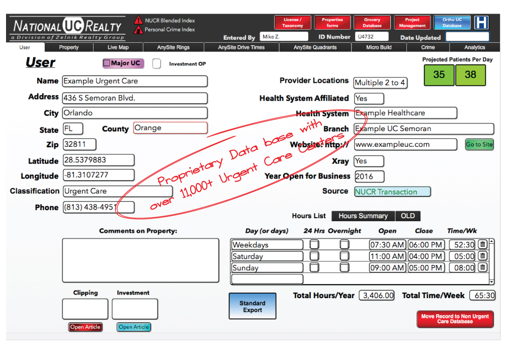
It all starts with the Urgent Care clinic information. Specific data about each Urgent Care is entered into this form. Some of the key fields include the Practice Name, Address, Phone, Latitude, Longitude, Classification, Provider Location Count, Health System Affiliation, website, Hours of Operation, Year Opened and on-site Xray availability.
How Does Your Site Compare?
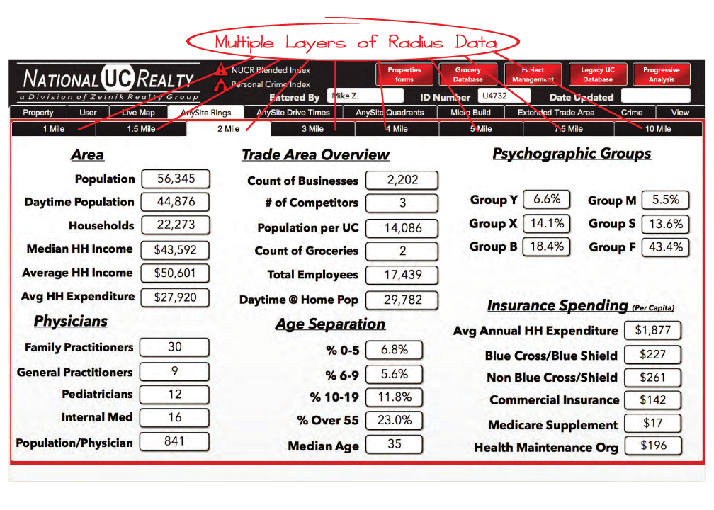
We catalog demographic, income, age, medical service, & psychographic data for 8 radius distances. This data is used to give an apples-to-apples comparison between any and all locations in a city, county, state, region or the whole country.
Drive Time Convenience
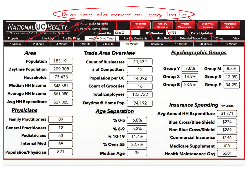
We also catalog demographic, income, age, medical service, & psychographic data for 10 Drive Times which we use in our benchmark comparisons.
Advanced GIS Software
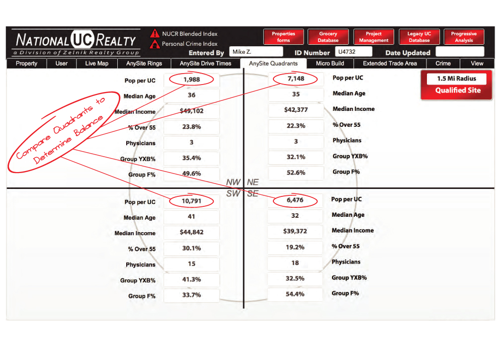
Our advanced GIS software allows us to break down any radius into 4 quadrants to get a better picture of the make-up of a trade area. Quadrants give insight as to the balance of the population, & whether an area may be at-risk due to socioeconomic or physical features (for example: lakes, rivers, airports, or large populations of low probability urgent care users).
Psychographic Data
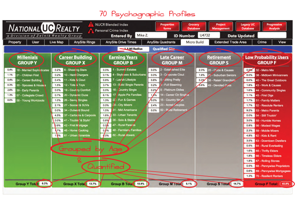
Our Psychographic Data is based on 'life stages' and segments households into 70 different groups. As people move through the stages of life, their behaviors change. The needs and demands of young singles differ dramatically from a family of six. As people age, gain new family ties, take on responsibilities, and gain or lose economic standing, they develop new patterns of behavior. We monitor existing and closed Urgent Cares to gain insights into which of the 70 groups are most & least likely to use Urgent Care clinics; we also evaluate which Psychographic groups live in the trade area as part of our Site Selection and Site Analysis projects.
Crime Index Data
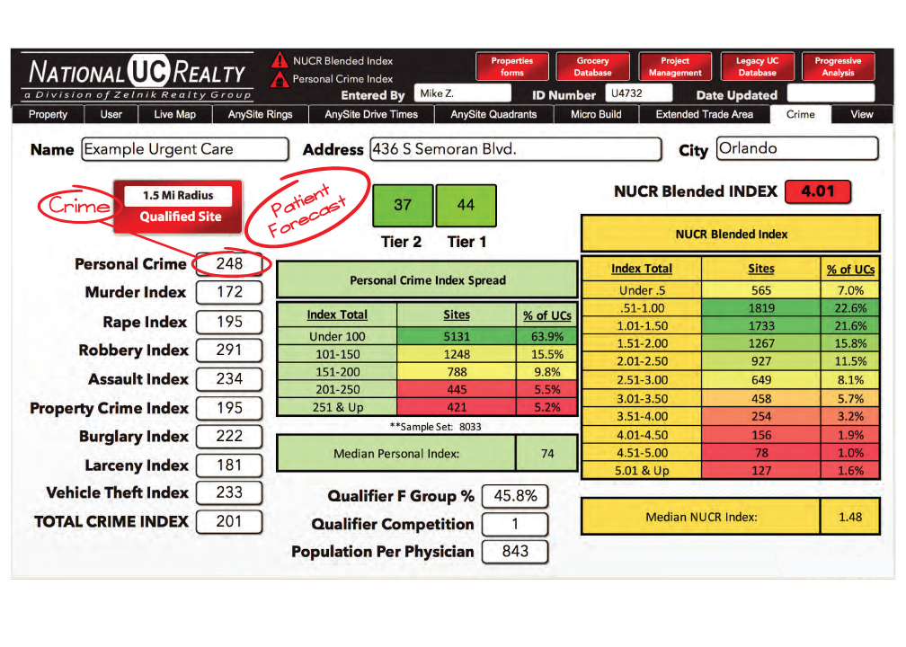
Using index data from the FBI & local municipalities, we are able to find the crime index for any location in the country. This data is returned in the form of an index value where 100 is considered normal. The Personal Crime index is important in evaluating trade areas. In regions where this index is high, we find there is often a large population of low probability Urgent Care users. The NUCR Blended Index score is a proprietary formula that integrates Psychographic data with Crime Index data to evaluate trade areas.
If you'd like to schedule a Free Consultation to discuss this in more detail, please call (813) 839-2026 or contact us.
Contact Us
Schedule a free consultation today
Working with us is like having your own in-house Real Estate Department — without the overhead. Call (813) 839-2026 or send us a note.